- 8:45 h
- 21.29 km
- 1,750 m
- 1,750 m
- 858 m
- 1,886 m
- 1,028 m
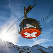
- Start: Engelberg, station
- Destination: Niederrickenbach
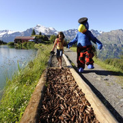
The Benedictine way leads from the cloister in Engelberg to the one at Maria-Rickenbach. The route is quite varied and offers beautiful panoramic views of the valley and mountains.
The path involves some strenuous climbs along the eastern valley side of Engelberg's portion of the Aa River. It grants very impressive views of the side valleys, the summit and glacier regions of the Unterwalden Alps. The mountain village of Oberrickenbach marks the lowest point of the trail.
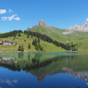
Niederrickenbach is also known as a pilgrim destination and as the cloister village of "Maria-Rickenbach." For the faithful it is a center of comfort and strength. Beautifully-tended hills, wild mountain meadows, craggy cliffs and a marvelous view characterize the landscape of Niederrickenbach. A visit to the «Musenalp» mountain tavern is worth the trip.
You'll find the best views from Rosenbold Heights. From here you can see the entire Engelberg Valley from above.
Note(s)
For hiking, follow the logo on the yellow signposts.
See also
Obwalden Tourismus
Bahnhofplatz 1
CH - 6060 Sarnen
Tel: +41 (0)41 666 50 40
Fax: +41 (0)41 666 50 45
E-Mail: info@obwalden-tourismus.ch
Internet: www.obwalden-tourismus.ch

Good to know
Best to visit
Directions
Tour information
Stop at an Inn
Organization
Engelberg-Titlis Tourismus
Author´s Tip / Recommendation of the author
Nearby