How would you like to arrive?
- 3:00 h
- 10.21 km
- 928 m
- 924 m
- 1,289 m
- 1,927 m
- 638 m
- Start: Mountain station chair lift Klingenstock
- Destination: Mountain station chair lift Fronalpstock
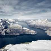
The steepest funicular in the world takes you to the car-free mountain village of Stoos. A chairlift takes you to the starting point of the hike - the Klingenstock. Of course, the ascent is also possible on foot. Those who set off in a westerly direction to the Rot Turm and Nollen should be sure-footed and free from vertigo. Far below, Lake Lucerne accompanies the hike over the ridge to the Huserstock. Then it's zigzagging down to the Furggeli on the mountain path hewn into the rock and secured with chains. The last ascent is the steepest, from the alpine hut at Furggeli up to the summit of Fronalpstock. If your heart began to pound a little harder during the uphill hike, at the summit the view of the mountain and lake world takes your breath away. On the terrace of the highest restaurant in the canton, you can relax and let the view continue to take effect. The chairlift takes you back to the mountain village of Stoos. If you still like, you can also hike down.
The hike is classified according to the difficulty level T3 of the SAC scale. For the walk, good hiking equipment, surefootedness, shoes with non-slip soles and good physical condition are strongly recommended. The trail is secured with chains from about the beginning of June (as soon as there is no more snow) until about the beginning of November. As long as there is snow, we advise against this hike for safety reasons.
Good to know
Best to visit
Directions
Tour information
Mountain Railway Tour
Nature Highlight
Stop at an Inn
Summit
Equipment
Directions & Parking facilities
Additional information
An association takes care of the maintenance and the associated security on the way. Sprightly seniors work on an honorary basis with the goal that the way is accessible also for families and seniors. The association is mainly financed by donations. More information can be found in the brochure here.
Stoosbahnen AG: 041 818 08 08
The Klingenstock lift operates weather permitting; the Fronalpstock lift operates daily in the high season and at weekends (weather permitting) in the low season.
Literature
At the stations from the Stoos railways there are free brochures with information to the Ridge Hiking Trail Stoos:
Adventure Map Stoos, Hiking Map Stoos-Muotatal, Brochure Ridge Hiking Trail Stoos
Author
Stoos-Muotatal Tourismus / Schwyzer Wanderwege
Organization
Schwyzer Wanderwege
Author´s Tip / Recommendation of the author
Frönelis playground & petting zoo on the Fronalpstock.
The ridge hiking trail is also suitable for families. Here to a blog from a guest.
Safety guidelines
Map
In the Regio Shop at the railway station from the funicular, you can buy a Hiking Map from Schwyz:
Nearby


![[Translate to Englisch:] Gästekarte Luzern Gästekarte Luzern](https://www.luzern.com/fileadmin/_processed_/6/4/csm_SGV_2017_aa603a6780.jpg)


