How would you like to arrive?
- 5:30 h
- 21.22 km
- 1,998 m
- 1,234 m
- 690 m
- 2,328 m
- 1,638 m
- Start: Lungern station
- Destination: Sörenberg, Post
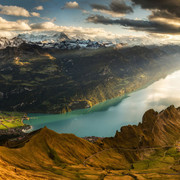
The hike starts in the village of Lungern on emerald-green Lake Lungern. After a short walk, you reach the valley station of the Lungern-Turren railway and take the aerial cableway up to Turren in comfort. From here you hike via Rückenegg and Zwischenegg over the Eisee saddle to the Brienzer Rothorn. The highest mountain in Lucerne offers a 360° panorama, over 690 mountain peaks are visible in good weather and, with a bit of luck, you might even catch a glimpse of the large ibex colony. Add to this the turquoise-blue Lake Brienz and the view of the UNESCO Entlebuch Biosphere - simply fantastic. Once the camera is packed up again, the newly renovated Rothorn summit restaurant offers delicious local menus to recharge the batteries for the second part of the hike and the descent. The path leads along the ridge with magnificent views to Lättgässli. Here, the route descends steeply for a short while on a concrete staircase and then returns to open terrain in the direction of Blattenegg. From here, the landscape changes to alpine meadows and moorland - which are particularly abundant in Entlebuch. Moors are among the rarest and most valuable habitats in Switzerland. In the UNESCO Biosphere Entlebuch there are a total of 46 raised bogs and transition bogs as well as 68 fens of national importance with a total area of approx. 26 km². Having arrived at the top station of the Rossweid cable car, you have reached your destination. The cable car takes you to Sörenberg in 10 minutes. A comfortable ride on the cable car back down into the valley to Sörenberg concludes the eighth and last stage of the Tell Trail.
INFORMATION: The Sörenberg-Brienzerhorn aerial cableway will be back in operation from 6 July 2024. From this date, Tell Trail stage 8 can be shortened from Brienzer Rothorn using the aerial cableway.
Walking time: approx. 5.5 hours | Hiking distance approx. 15 km (without cableways) | Total elevation gain 1,170 m (including cableways 1,992 m) | Total elevation loss 1234 m (including cableways: 1,530 m)
Good to know
Best to visit
Directions
Tour information
Mountain Railway Tour
Stop at an Inn
Summit
Equipment
Directions & Parking facilities
Falls die Etappe 8 des Tell-Trails als Tagesetappe absolviert wird:
Mit dem Zug bis zum Bahnhof Lungern oder mit dem Bus bis Lungern, Dorfkapelle
Additional information
Further information on the Tell Trail: www.luzern.com/telltrail
Author
Laila Bosco
Organization
Region Luzern-Vierwaldstättersee
Safety guidelines
• Good surefootedness
• Average navigation skills
• Elementary alpine experience
Nearby


![[Translate to Englisch:] Gästekarte Luzern Gästekarte Luzern](https://www.luzern.com/fileadmin/_processed_/6/4/csm_SGV_2017_aa603a6780.jpg)


