- 00:40 h
- 2 m
- 242 m
- 1,555 m
- 1,797 m
- 242 m
- 2.23 km
- Start: Rigi Kulm
- Destination: Rigi Staffelhöhe
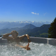
This high-altitude hike starts at just under 1,800 metres above sea level. The hiking trail is very wide and can also be walked effortlessly with a pram.
The hike can also be done in the opposite direction.
Notes
The current operating status of the railways and hiking trails can be found here. So that future generations can also enjoy the Queen of the Mountains, we ask you to dispose of your waste at the stations or take it home with you. Thank you.

Good to know
Best to visit
Directions
Rigi Kulm (1797 m) - Rigi Staffel (1604 m) - Rigi Staffelhöhe (1550 m)
Tour information
Barrier-Free
Stop at an Inn
Equipment
Sturdy shoes and clothing suitable for the weather. Possibly walking sticks. Food and drinks for the road.
Directions & Parking facilities
Exit A4 towards Küssnacht, follow signs to Vitznau.
You can reach the Rigi Kulm or Rigi Staffelhöhe stations by cogwheel railway from Vitznau.
Metered parking is available at the Rigi Bahnen stations (Goldau A4, Kräbel & Vitznau).
However, we recommend public transport instead of a car: sit back, enjoy and do something good for the environment to boot.
Author
Gäste-Service Rigi
Organization
Schwyzer Wanderwege
Author´s Tip / Recommendation of the author
At the Kräuterhotel Edelweiss I enjoy the excellent natural cuisine with many products from the hotel's own garden.